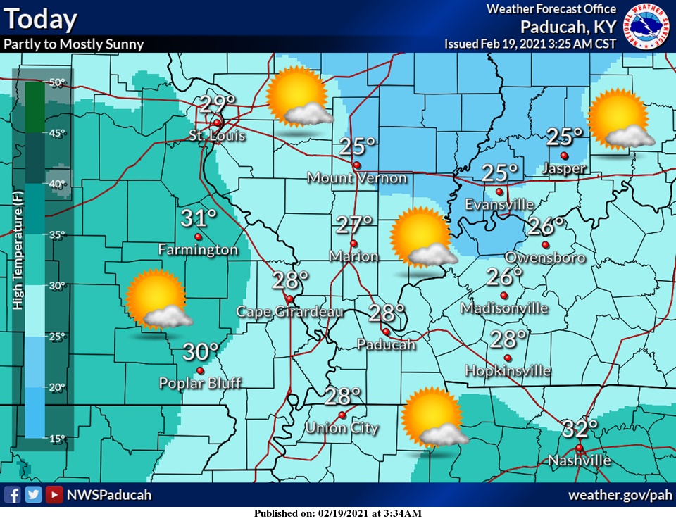
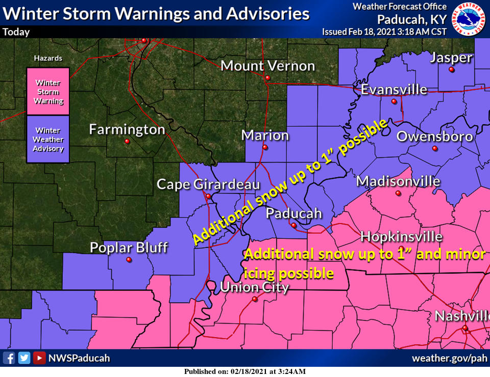
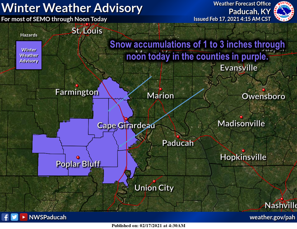
![Tuesday February 9, 2021]()
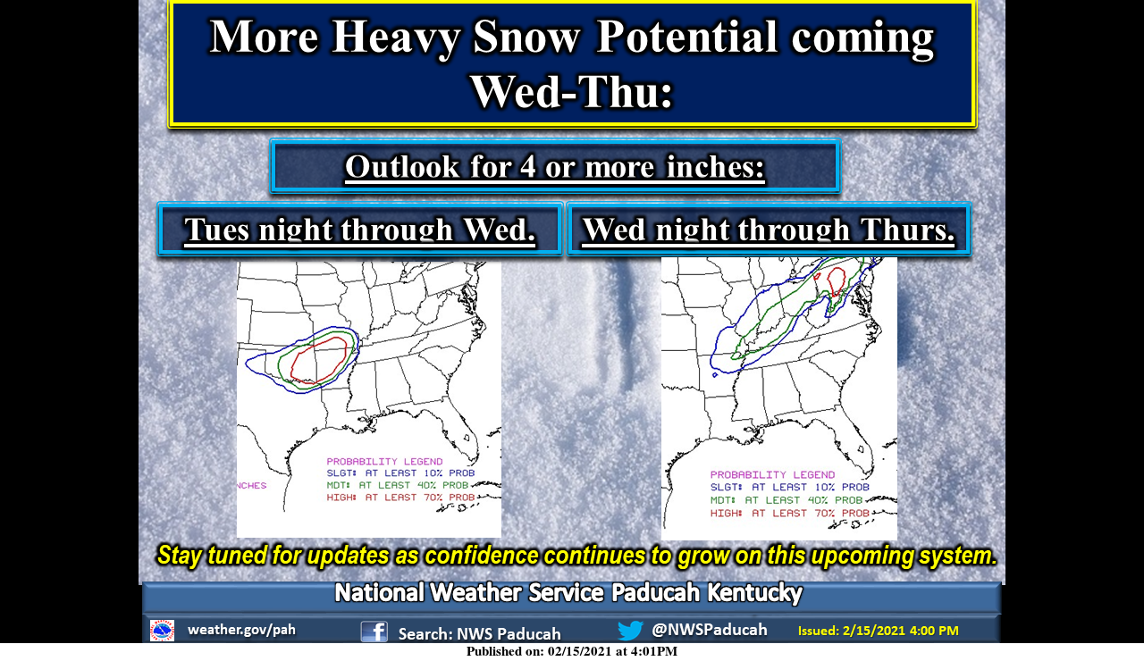
WINTER STORM WATCH TO BE IN EFFECT WEDNESDAY AND THURSDAY
The National Weather Service is urging area residents to be prepared for winter weather that is coming this week.
KWOC News spoke with Rick Shanklin, Warning Coordination Meteorologist with the National Weather Service in Paducah, about the upcoming system.
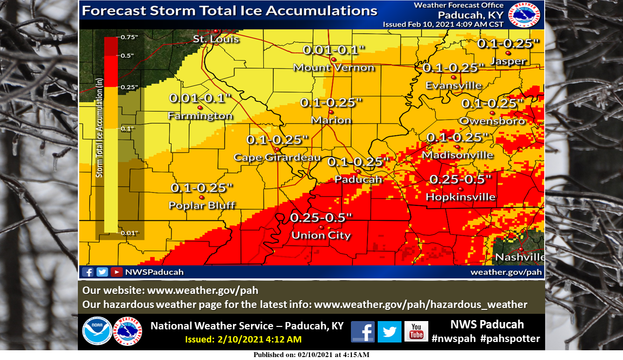
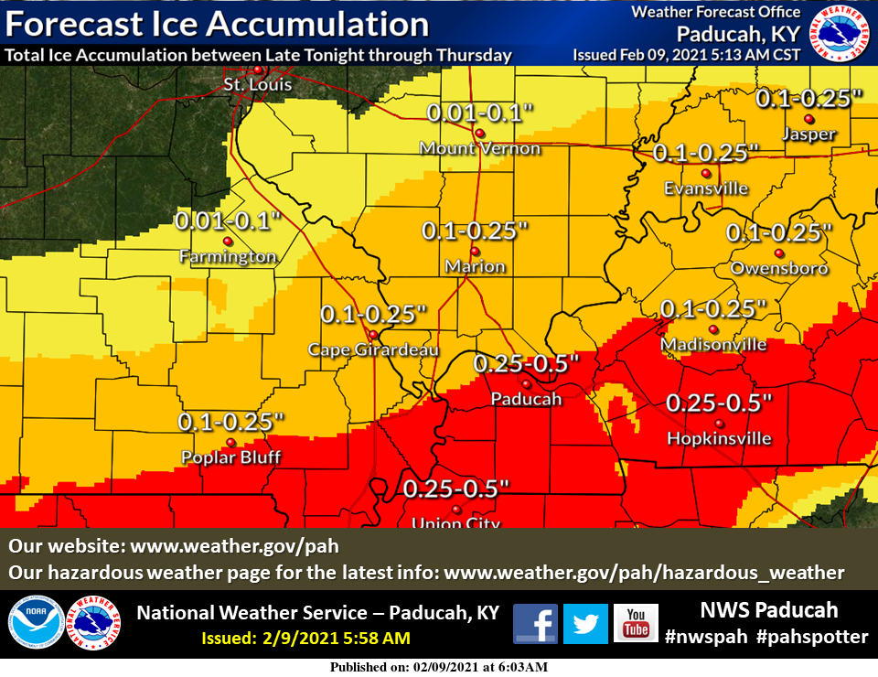
“That chance of wintery precipitation really is going to continue through much of the week, actually to Wednesday night, possibly even into at least Thursday morning across the area. Our main concern is the midweek system. Possibly beginning by late Tuesday night, certainly during the day Wednesday, and then especially Wednesday night.
That’s when we could see the greatest accumulations of ice across the region. Some areas, possibly even a quarter of an inch or more. Also look for some updates regarding that midweek system including a potential for some headlines here over the next day or so. And then we expect much colder air to arrive this weekend.
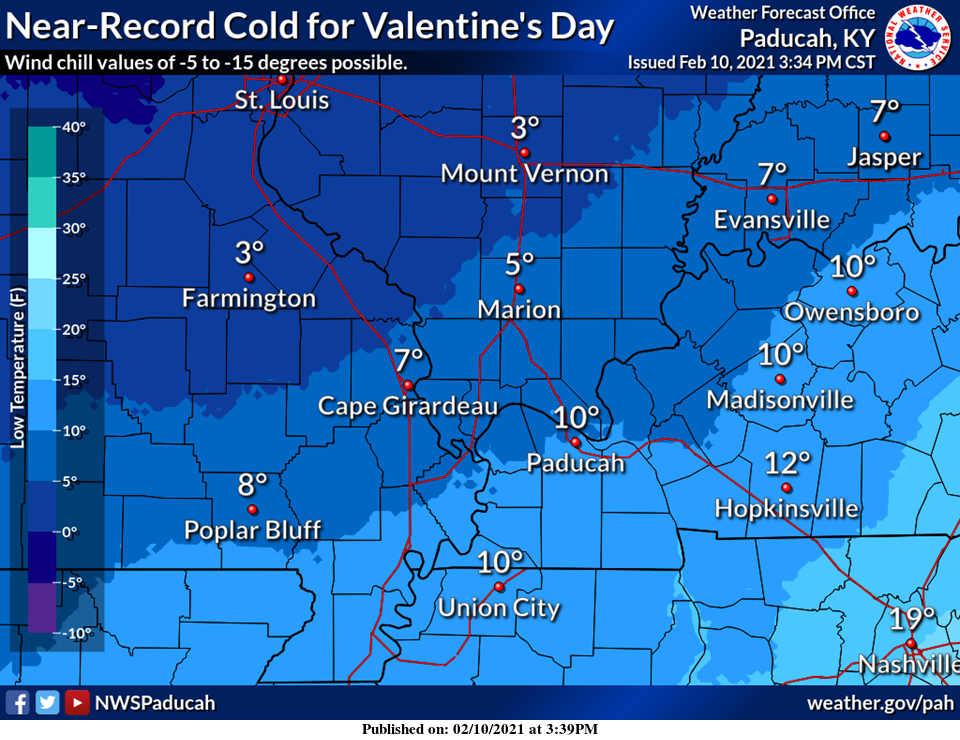
In fact, the coldest air of the entire winter season will be with us this weekend, so certainly any wintery precipitation we receive this week will be hard pressed to leave over the days following.”
A winter storm watch is currently set to be in effect from midnight tonight to noon on Thursday.